
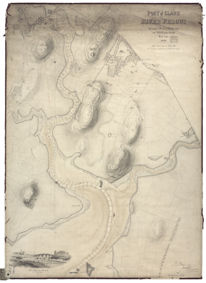
The Fergus
A mile to the eastward of the Beeves [rocks] is the principal and only navigable entrance to the River Fergus, which comes from the NNE amid vast banks of mud, and numerous islets and rocks. Having passed the Beeves, steer up for Feenish Island till you bring the tall square tower of an old castle (called Court Brown) in one with a house near the beach, bearing SSW. Keeping this mark on, you may steer up the Fergus till another tall square tower on Cannon Island (Cannon Castle) is in one with the north point of Low Island, WNW¼W; which is studded with white houses. You must then keep rather more to the northward for the round hill of Coney Island, until Cannon Island is in one with the peak of Grady Island, W¼S; when you must bear away for the east point of Coney Island; you will then shortly come into five and six fathoms, where you must anchor with the sharp peak of Coney Island bearing N by E, and Cannon Castle WSW1/3W in about six fathoms soft muddy bottom.
Beyond this it would be impossible to proceed without a pilot. The river beyond Coney Island winds through vast banks of mud, extending from 1 to 1½ miles from the shore, decreasing gradually in width from 600 yards, and varying in depth from nine to three feet up to the town of Clare [now Clarecastle], nearly seven miles in a direct line, and about nine following the channel.
At Clare the bed of the river is dry at low water, but there is a quay, alongside of which vessels load. Clare is a miserable place, though the shipping port of Ennis. It is a military station.
Pilots may be had at Low Island, but no vessel above 150 tons should go up to Clare.
To the westward of this principal entrance of the Fergus, there is a multitude of islands (some of considerable extent) and rocks; among which are various intricate channels, totally unfit for navigation, except for small vessels, on account of their narrowness, the strength of the tides, and the frequent shallows, though there are spots with 10 to 13 fathoms depth.
From the Sailing Directions for the Shannon Estuary, completed before 1848 by Commander James Wolfe RN, being the result of Surveys made by Order of the Lords Commissioners of the Admiralty.


No Comments
Add a comment about this page