The Newline, Clarehill, Clarecastle


The Famine in Clarecastle
The Famine had a devastating impact in the parish of Clare Abbey and Killone. Relief committees were set up in both parts of the parish, with the Catholic and Protestant clergy taking a prominent role. Petitions were organised and sent to the government seeking relief works not charity. The relief committee in Clare Abbey raised local subscriptions and used these funds to give employment to over 80 unemployed men. The men worked at road repairs in Clare Abbey, Killow and in Manus. They were paid about 10d per day. In the Killone area of the parish about 100 men were employed in drainage works. The government only donated £60 to the relief committees.
The government organised public works schemes in September 1846. More than 400 jobs were offered by the Board of Works at Clare Abbey, but such was the demand for relief that more than 700 turned up for work, with massive intimidation of overseers.
When Mr Hennessy, the overseer at the public works at Clare Abbey was fired upon and wounded on 5 December 1846, the public works scheme was suspended as a punitive measure. Starvation was inevitable as the works were closed down for more than three weeks.
The census statistics for the year 1851 show the profound impact of the Famine upon the parish. The population of the parish fell from 6,057 to 4,160, a reduction of about 33%. The number of houses fell from 945 to 673, a reduction of about 28%. One could reasonably assume that about one thousand people from Clare Abbey and Killone died from hunger and famine–related diseases and about a thousand emigrated between the years 1845 and 1850.
The Newline
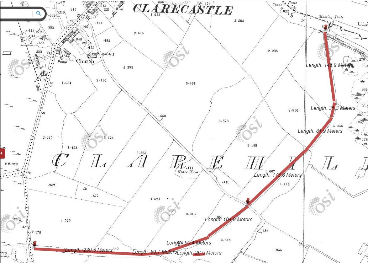
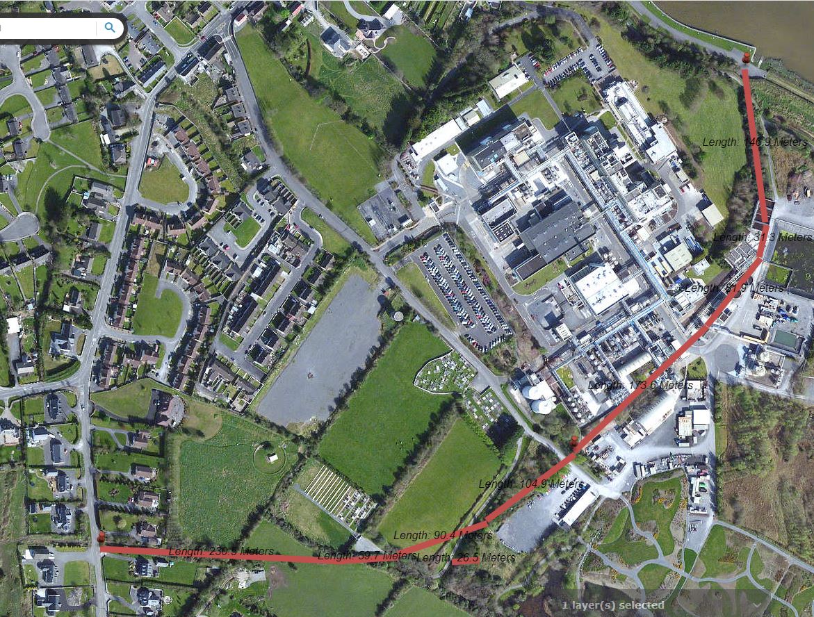
One of the relief works was the construction of a new road, a Newline, starting at the Quay and running west to the Lissane Road, a distance of about 940 metres. The road looped around the Hill of Clare, crossed the road serving Clarehill cemetery and joined up with the Lissane Road west of the Village.
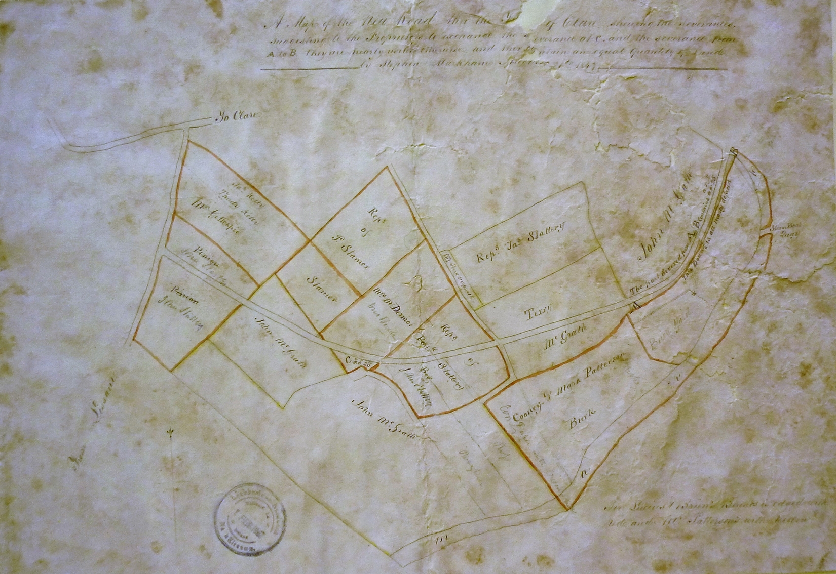
An 1847 map of the Newline was discovered in the Inchiquin Papers in the N.L.I. It was surveyed by Stephen Markham. It may be possible to get a sharper copy of the map but it reveals fascinating details. The quay for the steam-boats in shown as well as brick yards. All the fields that the Newline cut through with tenancies are shown. There is a McGrath house opposite the cemetery.
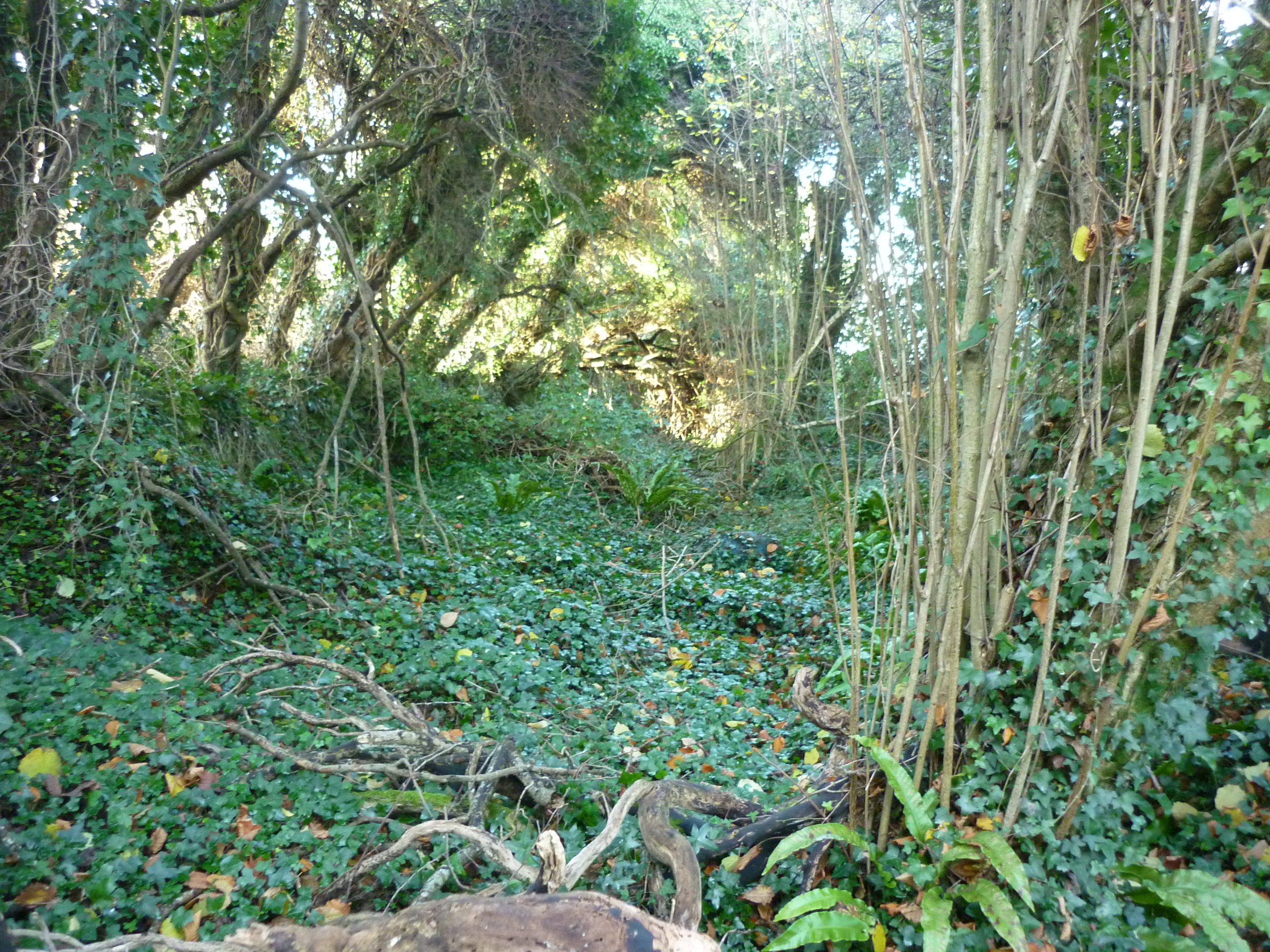
The Newline has been largely removed by development and farming practices. Sections do remain at either end of the Line, with about 100 metres or so intact on the Roche lands at Clare Hill close to the Quay and there are about 150 metres at the Lissane end. The road appears to be about 18 feet wide. A very small section of the Clarehill Road to the corcass remains, close to where the Clarehill Crossroads stood.
Along the track of the Newline, some land folios still bear an appurtenant – a right to pass and repass on foot and with horses and carts over parts of the lands in Lissane East and in Lissane West between points lettered on the registry maps.


No Comments
Add a comment about this page