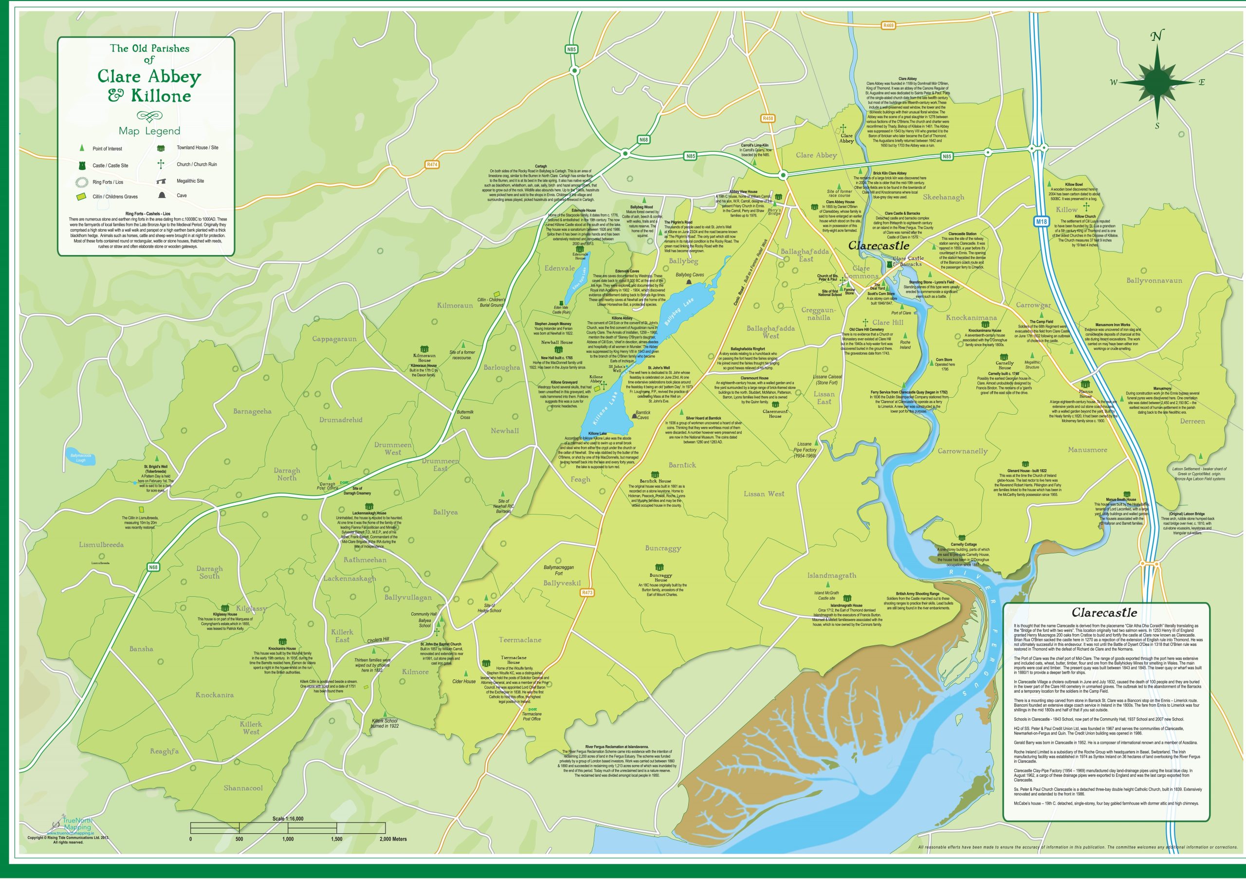
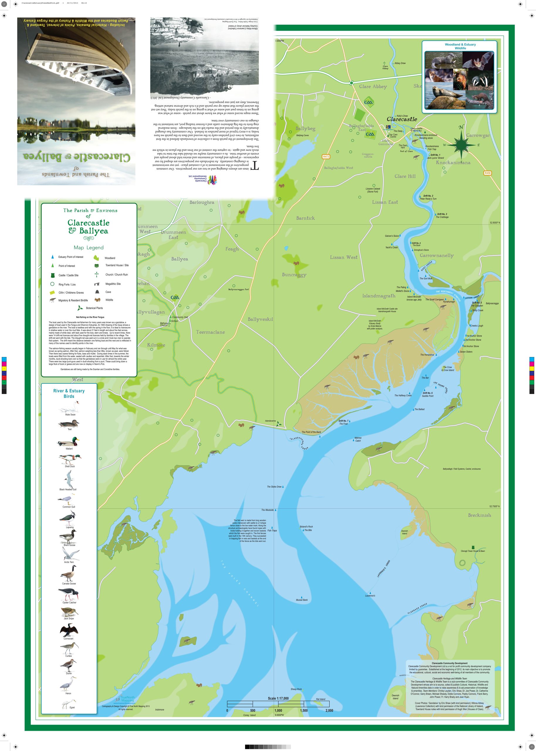
On Sunday 1 December 2013 in the Abbey Hall, Clarecastle and Ballyea Heritage & Wildlife Group published a very interesting and unique large-scale coloured map depicting the 49 townlands that make up the Parish. The map shows the location of historical sites and events. A detailed map of the Fergus appears on the reverse of the map showing the fishermen’s names for the various parts of the river. These have been recorded for the first time and are now preserved for future generations. Attractive illustrations of wildlife on the Fergus Estuary and localities are shown. The history of the gandalow (the fishing boat unique to the Fergus and Shannon estuaries) and net-fishing is highlighted.
The map is folded with very attractive covers. Flat editions of the map are available for display in schools, public areas and homes.


No Comments
Add a comment about this page