
Manusmore
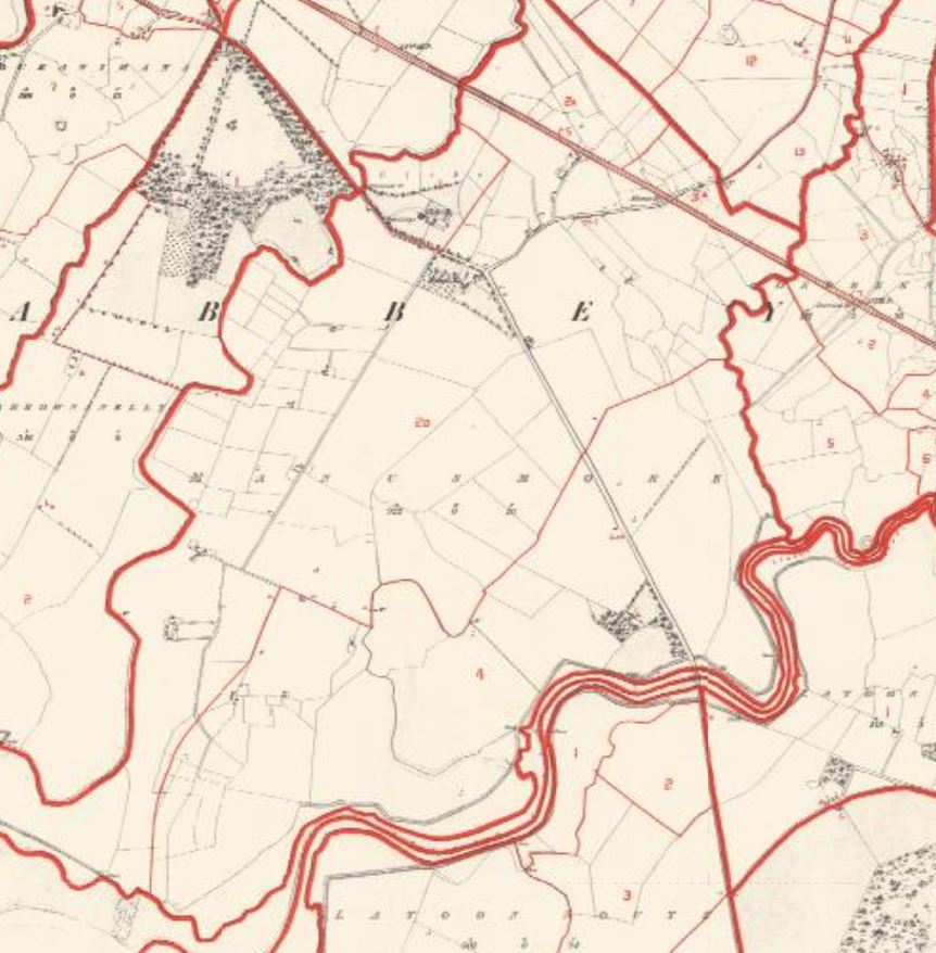
Located on the boundary of the parishes of Clareabbey and Kilnasoolagh (Newmarket) with the former main road (now R458) and the M18 along its western boundary, Manusmore has an area of 954 acres or 386 hectares and is the largest townland in the parish. Manusmore is one of five Clareabbey parish townlands located in the Doora district electoral division (DED) and is bordered by Ballyvonnavaun and Carrowgar to the north, Carrownanelly to the west, Derreen to the east and the Kilnasoolagh townlands of Latoon North to the east and Latoon South to the south.[1]. Locally the townland is often referred is as Manus.
In 1855 the immediate lessor for much of the townland was Col George Wyndham (1787-1869), later ennobled as Baron Leconfield in 1859. The landed estates database indicates that Wyndham held extensive estates in county Clare and the main home was Petworth House in Sussex.[2]
Joseph Power provides a detailed history of land occupation at Manus in his discussion on the Healy family who are shown as occupiers of extensive farmland of the townland in the early years of the cancelled books.[3] Terence Healy held 536 acres in lot 2 at the time of the Griffith Valuation and this land was later purchased by the McInerney family and was held in fee by the family. James Healy held 254 acres in lot 4aB but this lot’s sale in 1926 is noted in the cancelled book.
A feature of the property listing in the Griffith Valuation for Manus are the fourteen houses valued between five and ten shillings which listed their occupant; however, these names disappear from the cancelled books and are merged with the occupier e.g., Terence Healy held ten houses in lots 2b-2k and these were added to his valuation liability. Later there is extensive creation of small lots with houses and land or gardens. This is probably due to Manus position along the main road and employment opportunities for families in the local large farms.
Lot 1a was held by Rev Robert Harris in 1955 and described as Rector of Clareabbey on his 1884 death record. Lot 1a contained the Glebe House and land held by the Church of Ireland parish minister. Power notes that Rev Harris was the last resident minister as the local population could no longer support its own minister. [4][5] St Mary’s Church was located in Clarehill.
The 1901 census of Ireland counted fifty-one people in eleven household which increased to fifty-eight people in thirteen households at the 1911 census.[6]
[1] (https://www.townlands.ie/clare/islands/clareabbey/clareabbey/skehanagh/) (accessed 11 Feb 2023).
[2] (https://landedestates.ie/estate/1812) (accessed 28 Feb. 2023)
[3] Joseph Power, A history of Clare Castle and its environs, Ennis, 2004 (pp. 363-369).
[4] Ibid (pp 121 & 259)
[5] Death record Robert Harris irishgenealogy.ie.
[6] (http://www.census.nationalarchives.ie/pages/1901/Clare/Doora/Manusmore/) and (http://www.census.nationalarchives.ie/pages/1911/Clare/Doora/Manusmore/) accessed 28 Feb 2023.


No Comments
Add a comment about this page