
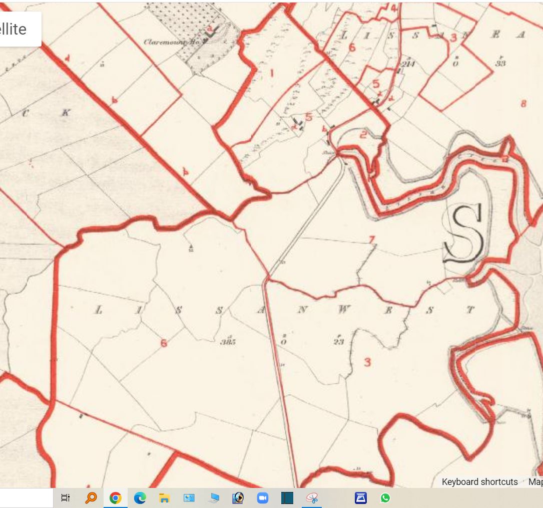
Lissane West
Lissan West, which has 159 hectares or 393 acres, is located west of the village with Ballaghafadda West to the north, Barntick and Buncraggy to the west, Lissan East to the east and Islandmagrath to the south.[1] The townland also has frontage with the River Fergus to its east. Like its neighbour Lissan East, the townland is generally spelled as Lissane West.
The immediate lessor of Lissan West in 1866 was Sir David Roche Bt. (1791-1865) of Carcass, Limerick who held land in other townlands of the parish. While the townland was split into seven lots in 1855, there were three named occupiers of house and land; Thomas Lynch, Patrick Lynch and Wyndham F. Patterson one occupier of a house (lot 5b).
Lot 7a held by Patterson in 1855 was later held by members of the Roche family until 1924 when the lot was split up into lots 7-15. In the period 1855-1970 the lots held by the two Lynch family continue to be held by members of the family with some changes noted in the 1934-70 cancelled book.
The 1934-70 cancelled book records the creation of lot 6C for the Clarecastle Clay Products Factory Limited in 1946 which occupied some seventy-two acres. A 1957 newspaper article reports that the factory employed over forty people and paid three to four hundred pounds in wages per week.[2]
At the 1901 census of Ireland there was just one household with six people, this increased to two households with eleven people in 1911.[3]
[1] (https://www.townlands.ie/clare/islands/clareabbey/clareabbey/lissan-west/) (16 Mar. 2023).
[2] Dublin Evening Mail, 25 Oct 1957.
[3] (http://www.census.nationalarchives.ie/pages/1901/Clare/Clareabbey/Lissane_West/) (http://www.census.nationalarchives.ie/pages/1911/Clare/Clareabbey/Lissan__West/ (accessed 16 Mar. 2023).


No Comments
Add a comment about this page